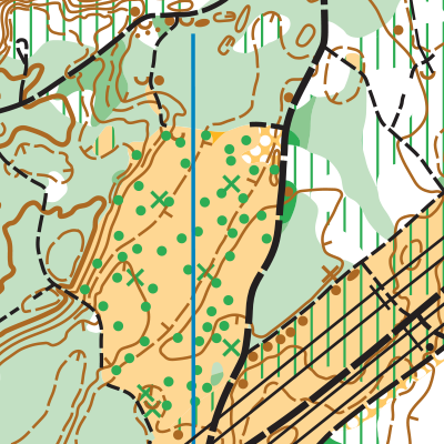
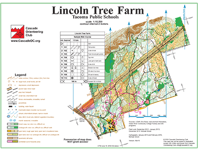
Lincoln Tree Farm is best known for its whack-a-mole brush piles. Swaths of logged areas, mapped as light-yellow-tan “rough open area” on the map, are speckled with green dots representing tall brush piles. A major dirt road and power lines run through the center of it all, providing a confident feature to re-orient oneself on. There are some delightful open forest areas of the map, where there is little underbrush, that may cause bouts of gleeful skipping. This is balanced out by the areas of low-lying blackberries on the map, that cause tripping.
Lincoln Tree Farm is also a bit unique due to its 2-meter contours, instead of the traditional 5-meters. There are also areas that use form-lines, which are dashed contour lines that appear between the regular contour lines, thus providing areas with contour information for every 1-meter of elevation! Advanced course participants will be challenged when navigating these subtle contours in the forest.

Note: Samples of the map are provided here for educational purposes only; the map shown here is not kept up-to-date. The course shown is a Beginner/Intermediate course, and actual controls do not exist in the terrain.
The purpose of providing these navigational and physical ratings below is to provide greater context for how challenging an orienteering course at this venue might be. For example, an advanced-level course at a local city park will be easier to complete than an advanced-level course in the mountains.

