2024 Choose Your Adventure Series #6 – Bog Slog!
CHOOSE YOUR ADVENTURE
Sunday, December 29 at Lord Hill Regional Park – South Entrance in Snohomish, WA
Meet Director: Patrick Nuss
This event is pre-registration only which closes 9pm Friday, December 27.
The Bog Slog, now in its 45th year, is the extra tough and extra muddy halftime race to the Winter League, and a fantastic opportunity for students who have graduated from WIOL to return for a holiday reunion with friends!
The Bog Slog concludes the Choose Your Adventure Series, which means that we are offering two mass-start, point-to-point courses (The Bog Slog & The Bog Jog) for the advanced navigators, as well as a Choose Your Adventure style race for beginners, intermediates, and trail runners!
This year, as in recent years, we will have a separate mass start for each course. See the schedule for course start times.
- If you’re a runner, this means an opportunity to stay with similarly-paced runners on the same course until elevation gain and navigational challenges split the pack.
- If you’re a hiker, this means that you don’t wait long for a start, and the herd of running orienteers departs rather quickly, leaving you with a nice hike-with-a-purpose through Lord Hill Park.
As always, The Bog Slog advanced courses are longer and more challenging than our usual Winter League courses. Some participants drop down a level for ease, while others treat this as the ultimate challenge, often sharing the navigation fun and bragging rights for completion.
COURSES
Course designer(s): Ethan O'Connor
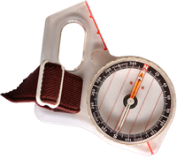
The Bog Slog (Long Advanced) and Bog Jog (Short Advanced) courses are point-to-point, meaning that you need to visit the checkpoints in a specific sequence. Fastest time wins. Most checkpoints will require off-trail navigation.
The Choose Your Adventure course (intended for beginners, intermediates, and trail runners) is a score-o, meaning that you can visit as many checkpoints as you can, in any order that you like, until the course closes. Most checkpoints are on or very near trails.
RACE DISTANCES:
The Bog Slog (Long Advanced) – 7.2 km, 20 checkpoints, 475 m climb, 1:10000 scale map
The Bog Jog (Short Advanced) – 4.9 km, 13 checkpoints, 350 m climb, 1:10000 scale map
Choose Your Adventure – 24 checkpoints, 3 hour time limit, 1:10000 scale map. The course is a mix of 8 easy checkpoints, 12 moderate checkpoints, and 4 difficult. These difficulty levels are indicated on the description sheet on the map.
The start this year is in the lower quarry (not the usual start location), requiring a 750m walk with 40m of climb from the south parking lot. Please allow 15 minutes for the walk to the start area.
Similar to recent years, there is an option to take a shortcut from the longer Slog course to turn it into the shorter Jog course: after punching #5, follow the dashed line on the map to #13 (which is Jog #6), and continue the course from there. Tell the finish tent that you switched when you return!
How are point-to-point courses measured?
Courses are measured as the crow flies, in a direct line from checkpoint to checkpoint. Unless you have wings, you will travel farther than this distance! Courses are measured in kilometers, so a good rule of thumb is to simply round up to miles to estimate how far you will go. So in a 5 kilometer race, you’ll likely travel up to 5 miles.
How does the scoring work for Choose Your Adventure course?
All 24 checkpoints are worth the same amount: 1 point per checkpoint. The maximum score is 24 points. The first person or team returning with 24 points wins!
There’s a time limit of 3 hours, and for every minute late, there’s a 1 point penalty.
COURSE & MAP NOTES
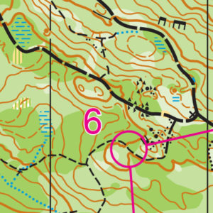
Lord Hill Park is a large wooded park with a great variety of vegetation and an extensive trail system. Trails vary from wide gravel roads to narrow trails. Vegetation varies off trail from run-able to fight. Full body cover is recommended.
Hazards include slippery trails, steep elevation change and varying levels of vegetation on the off trail routes.
Lord Hill is a popular park for mountain bikers. Many of the trails are multi-use and shared, so be aware of your surroundings and look and listen for them. In the north area of the map, there is a hill with some areas marked out of bounds (purple crosshatching). These areas contain one-way mountain-bike trails, on which mountain bikers ride VERY FAST downhill, exiting onto the shared trails. Park management has asked us to stay away from these trails, so we’ve designed the courses to avoid these areas and make traversing them a dubious or unattractive route choice.
There are no rootstocks or tree stumps shown on the map used for this event. Hundreds of rootstocks and tree stumps were mapped back in 2011, but since then, windstorms have created many new unmapped rootstocks. We don’t want orienteers frustrated with this major inconsistency of the map, and we don’t have the time, especially after the most recent bomb cyclone, to re-map every rootstock and stump over a huge area, so we decided to not show any. In addition to being more consistent, the map also benefits by being significantly more legible. Use the contour lines!
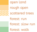
In most areas of the courses, Medium Green (408: Walk / Slow Run) means large sword ferns with varying amounts of junk underfoot. The vegetation is mapped broadly and you will encounter unmapped islands of Dark Green (410: Vegetation, “Fight”) in all shades of vegetation, but you shouldn’t find yourself fighting through blackberries or devil’s club or dense shrubs! I’ve done my best to make sure routes that look good on the map won’t throw you up unreasonably huge unmapped thickets.. Some areas have patches of sparsely growing devil’s club and/or low thorny vines which you can pass through easily if you take care.
We often talk about route choice in binary or discrete terms, but Lord Hill Regional Park is a great place to think about route choices on a continuum. Both the Slog and Jog courses this year feature some longer legs with clear route choice options, but many of the sequences are about keeping you off trail in fairly open forest for multiple controls in a row, and here the route choice is about things like knowing what angle of side slope works for you on different types of ground, how to balance distance versus elevation change, how steep is too steep, and generally how to work with the terrain instead of against it as you move between controls. For some people this may mean barreling along straight compass shots, and for some it may mean a flowing route deftly threading paths of least resistance.
These decisions are very personal and individual when you’ve been off trail for 700m and you’re standing chest deep in sword ferns trying to decide where to take yourself next. Have fun!
SCHEDULE
08:00am – Check-in opens
09:00am – Check-in closes
The start for all courses is in the lower quarry (not the usual start location), requiring a 750m walk with 40m of climb from the south parking lot & check-in area. Please allow 15 minutes for the walk to the start area.
09:20am – The Bog Slog (Long Advanced) mass start
09:25am – The Bog Jog (Short Advanced) mass start
09:30am – Choose Your Adventure mass start
12:30pm – Choose Your Adventure time limit ends
01:00pm – ALL COURSES CLOSE Return to the finish by course closure, even if it means cutting your course short.
PRICES
There will not be any day-of-event registration.
PRE-REGISTRATION PRICES
$22 base price
– subtract $5 for CascadeOC members
– subtract $5 for using your own e-punch
Participating as a group? Just $5 for each additional adult (18+) group
member, no cost for additional minors.
What’s an e-punch?
An e-punch records your race. At each control, you’ll dip the e-punch into an electronic box, which will beep and flash as confirmation. After you finish, you’ll download the e-punch at the download tent and get a receipt that show which controls you visited and how long you took between each; these are your “splits.”
Part of the fun of orienteering is comparing your splits with people who completed the same course, and discussing the routes you took!
SIGN UP
LOCATION
PARKING
Park in the lot at the south entrance to the park, from the entrance from Old Tester Road. Please try to park as efficiently as possible, as in previous years we’ve taken up the entire lot!
CARPOOL
Looking for a carpool? Join the club email group and share your request to find a ride.
THE MAP
Covering 1,463 acres of forest, ponds, and open meadows, Lord Hill offers some of the best navigation west of the Cascade Mountains. It features rolling hills, a wide-ranging trail network, and enough navigable land to have back-to-back events on a 1:10,000-scale map with little to no overlap.
Though Lord Hill has north and south entrances, the club routinely uses the southern entrance for its ample parking and closer access to “the bowl,” an open, grassy area ideal for the arena-style finishes used in larger events.
Since 2014, Lord Hill has been the preferred location for the annual Bog Slog during the winter, and is often used for another event during the year as well.
Read more on the map pageSAFETY & ETIQUETTE
Return to the Finish
All participants MUST return to the finish and download their e-punch or turn in their punch card.
Even if you have not finished your course, you must still return to the the finish and confirm with event staff that you have returned safely.
Out of Bounds
Some areas may be marked out of bounds. It is imperative to respect these boundaries to maintain our relationships with land managers. Participants MUST NOT go out of bounds. Any participant caught going out of bounds will be disqualified.
Course Closure
All participants MUST return to the finish by course closure time. If a participant does not return by course closure, event volunteers will begin coordinating a search party.
If you need a long time on the course, start as early in the start window as possible, wear a watch, and be prepared to cut your course short to make it back by the course closure time.
Whistle
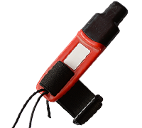
All participants MUST carry a whistle on the course. Complimentary whistles are available at the start tent (please only take one).
If you are injured on the course and need assistance, blow three long blasts to call for help.
If you hear a call for help, abandon your course to find the person in distress.
Voices
Part of the fun and fairness of orienteering is navigating your own course, so please be polite when you find a checkpoint and don’t holler that you’ve found it.

