Winter Wednesday #3 – Jackson Park Golf Course
[Update 2025-02-11 1 PM: current snow conditions, course data and descriptions, restroom access]
Winter Wednesdays is a new series offering training opportunities between the Winter League meets. The night training events are low-key with two point-to-point courses, the Easier with reflective control markers and the Harder with non-reflective markers. In addition, a Score-O format course will be offered. The timing is self-provided if you so choose; there will be no punching (neither manual nor electronic).
The third and final event will be February 12th at Jackson Park Golf Course (north Seattle) on a new map.
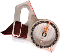
At this event we’ll combine the compass skills from Lynnwood and the reading details practice from North SeaTac with topography, often with large features but occasionally with smaller ones (at night, most likely the latter will be more usable for navigation; the former, for generating fatigue).
Please check in before going out on a course and check back in before leaving the venue. (We don’t want to search for you in the dark.)
Remember to bring a headlamp or flashlight. Whistles are required.
COURSES
Course designer(s): Mike Schuh
Courses data
Easier: 1.1 km, 20m climb, 10 controls
Harder: 3.1 km, 85m climb, 17 controls
An All Controls map will be available for those who wish to design their own course (or help with marker pick up). Participants wishing to try cell phone orienteering can be accommodated; please contact the Very Benevolent and Most Gracious Meet Director by noon Wednesday (please have contact information for both the navigator and runner beforehand).
How are courses measured?
Courses are measured as the crow flies, in a direct line from control to control. Unless you have wings, you will travel farther than this distance! Courses are measured in kilometers, so a good rule of thumb is to simply round up to miles to estimate how far you will go. So in a 5 kilometer race, you’ll likely travel up to 5 miles.
COURSE and MAP NOTES
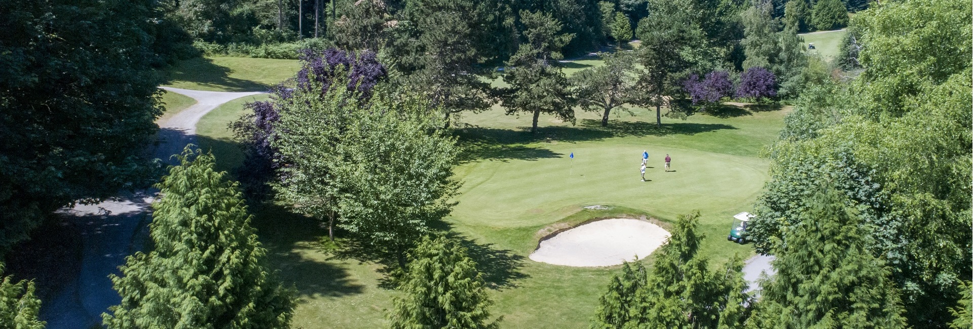
New map! Like the other events in this series this one will also be on a golf course (North SeaTac has disc golf, hence the narrower and shorter fairways). However, Jackson Park is not flat – total vertical relief is ~35m (nuthin’ compared to, say, Salmon la Sac, but more than many COC maps). It covers 161 acres (0.65 sq km), includes a conventional 18 hole golf course (“the driest public course in the City of Seattle”), a short “Executive 9” course, a putting green, several ponds, some power lines, and, from a few very special places, views of Link Light Rail. There is a driving range, a Pro Shop, and a cafe.
There will be access to restrooms near/in the Magnificent and Most Glorious Event Arena. In addition, there are four portable toilets in the terrain, each mapped as “small building” and marked with a purple “T”: 125m SE of start, 375m N, and a pair 350m NW. BYOTP (seriously).
The forested areas are typical Puget Sound lowland with second growth trees and varying densities of blackberries. Some forested areas, however, are truly open forest with very little undergrowth. Many of the open forests are bounded by a thin “wall” of foliage created by the outer branches of the trees. A step or two past this thin layer will lead to nice open woods. The fairways offer unconstrained travel, greens and sand traps notwithstanding.
Small bits of blackberries are not mapped where easily circumvented.
There are a few hazardous pits in the”Executive 9″ section, marked with black Vs. Expected route choices will not go near them. There are a couple of out of bounds areas.
Black Xs are larger signs and benches or trash cans that do not appear to have moved recently.
Black Os are poles of various kinds. There are power lines that cross the area and while the related poles are shown, the power lines themselves are not: drawing them would clutter the map without adding much value (visually dominant during the day, they effectively are invisible at night).
A few drinking fountains are marked with the blue “asterix” symbol. They are turned off.
The venue is bounded by a fence which can serve as a safety feature but it is not completely mapped (this concerns the eastern and far western boundaries, beyond expected route choices) (it is acknowledged that “choices” might differ from actual travel).
Website: Jackson Park Golf Course
Course notes
As at the previous Winter Wednesday events there will be two courses offered, Easier and Harder. Easier will be a beginner’s course and can be completed by staying on paved paths. There will be three controls where the direct path will lead the adventurous across open fairways where basic compass skills (follow a heading, aim off) should suffice. Instruction on these techniques will be available.
Like the earlier events, there will be a significant increase in technical challenge with the Harder course. Nearly all legs will lead participants off trails (as well as possibly leading them astray). In particular, a few of the longer legs will offer opportunities to sample the patches of open forest – if the map shows “open forest” it will be possible to travel directly through it (same for “open land” and “open land with scattered trees”). Choosing direct routes using compass skills is encouraged – this is a training event, after all.
As of Monday afternoon (February 10th) the venue still has patches of snow but waaaay less than we experienced at Fire Mountain this past Saturday. With above freezing temperatures and sun scheduled for Tuesday and Wednesday the snow is expected to continue melting. The fairways are mostly clear and forested areas don’t have any snow at all.
Please avoid crossing greens (marked on the map as “yucky olive green” with a purple line border) or entering sand traps. There are several places where golf flags (used to mark holes) are in locations apart from actual greens. These are ordinary lawn/fairway areas and travel near them is OK. It’s the surface of the greens that we need to avoid. There is a putting green near the entrance to the venue (at the base of the hill near the Magnificent and Most Glorious Event Arena) and participants are encouraged to study it carefully. There will be a quiz.
– Mike Schuh
SCHEDULE
5:28 pm – sunset
6:00 pm – civil twilight ends
6:00 pm – 8:00 pm: Start window (no assigned start times)
8:30 pm: Course closure
Report to Finish by 8:30 pm even if you have to abandon your course.
Why is there a start window?
This event uses an interval start, which means that participants are started in waves instead of all at once. When you arrive at the start tent, find the chute for your course and follow the start volunteer’s instructions.
PRICES
PRE-REGISTRATION PRICES
$12 base price
– subtract $4 for Cascade OC members
Participating as a group? Just add $5 for each additional adult (18+) group
member, no cost for additional minors. Max group size is 3 including the group leader.
SIGN UP
Online pre-registration closes: Tuesday, February 11th, at 11:59 PM
Day-of-event registration will not be available.
LOCATION
DIRECTIONS
Street address is 1000 NE 135th St, Seattle. From I-5 head east on NE 145th St, turn south (right) on 15th Ave NE, and then turn west (right) on NE 135th St (traffic light). Parking lot is a fifth of a mile, on the right. Alternatively, from the Northgate area, head north on Roosevelt Way NE, continue straight across NE 125th St (now on 10th Ave NE) about half a mile to the parking lot.
Metro Transit route 348 is available on 15th Ave. NE, the east side of the park.
For those who like numbers: 47.7272, -122.3166 Or maybe 551240 5286207?
PARKING
The main parking area is behind the multicolored “Jackson Park” sign. Check in (and the Magnificent and Most Glorious Event Arena) will be through the gate at the northwest corner of the lot and up the hill toward the Pro Shop and cafe.
CARPOOL
Looking for a carpool? Join the club email group and share your request to find a ride.
THE MAP
No map preview available
SAFETY & ETIQUETTE
Return to the Finish
All participants MUST return to the finish and download their e-punch or turn in their punch card.
Even if you have not finished your course, you must still return to the the finish and confirm with event staff that you have returned safely.
Out of Bounds
Some areas may be marked out of bounds. It is imperative to respect these boundaries to maintain our relationships with land managers. Participants MUST NOT go out of bounds. Any participant caught going out of bounds will be disqualified.
Course Closure
All participants MUST return to the finish by course closure time. If a participant does not return by course closure, event volunteers will begin coordinating a search party.
If you need a long time on the course, start as early in the start window as possible, wear a watch, and be prepared to cut your course short to make it back by the course closure time.
Whistle
All participants MUST carry a whistle on the course. Complimentary whistles are available at the start tent (please only take one).
If you are injured on the course and need assistance, blow three long blasts to call for help.
If you hear a call for help, abandon your course to find the person in distress.
Voices
Part of the fun and fairness of orienteering is navigating your own course, so please be polite when you find a checkpoint and don’t holler that you’ve found it.


