Pre-registration is required. There is no day-of-event registration.
Site Map is here.
To celebrate the end of another successful Winter League season, we are hosting a low-cost 3-person WL Relay at Marymoor Park in Redmond on Sunday, February 19th. We hope you join us for the fun and excitement!
Marymoor is a mostly flat, open, no-forest park, so this event will be more sprint-like. How it will work:
- Gather your team of three and decide your team name and who is running which leg.
- Legs 1 and 3 will be equal in distance and difficulty. If you choose Leg 1, you will be part of the mass start at 11 am.
- Leg 2 will be easier than legs 1 & 3. Leg 2 will be equivalent to JV Rookie/Advanced Beginner.
- If you want to participate but do not have a team you can do that too!
- Everyone registers in the Public Registration system here. When you register:
-
- ONLY if ALL three team members were WIOL runners this season, choose WIOL Relay (Leg 1, 2, or 3).
- All others choose OPEN Relay (Leg 1, 2, or 3).
- There are no other restrictions when forming a team.
- Be sure to tell us your team name and list of teammates when you register.
- If you want to participate but do not have a team, just choose the seventh-course option “I don’t have a team, please pair me up” and we will do that for you.
COURSES
Course designer(s): Nancy Devine
| Course | Controls | Length | Climb |
| Leg 1 | 20 | 2.9–3.0 km | Negligible |
| Leg 2 | 17 | 2.4 km | Negligible |
| Leg 3 | 20 | 2.9–3.0 km | Negligible |
How are courses measured?
Courses are measured as the crow flies, in a direct line from control to control. Unless you have wings, you will travel farther than this distance! Courses are measured in kilometers, so a good rule of thumb is to simply round up to miles to estimate how far you will go. So in a 5 kilometer race, you’ll likely travel up to 5 miles.
COURSE NOTES
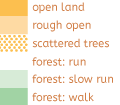
Get ready for some fast relay racing! Marymoor Park is a mixture of paved trails (always watch out for bikes as you cross the trails!), grassy fields, open forest, sports fields, and more. The terrain is very flat; there are only two contour lines on the whole map. Form lines indicate shallow dips and rises in the terrain.
The relay consists of three legs. The total relay distance of the three legs is 8.3 km, 57 controls and virtually zero climb. The course will be very fast, with an expected winning time of 1 hour. Legs 1 and 3 are more difficult navigation, while Leg 2 is designed for the advanced beginner.
At the mass start, the first leg runners will have one of four map variations. Although following is allowed, be careful and be warned, the competitor you are following may not be running your variation! Be prepared for lots of changes in direction and a lot of controls in a small area. Many controls can be seen simultaneously, so it is important that you CHECK the control numbers on your description sheet and at the controls. And, remember to watch out for bikes!
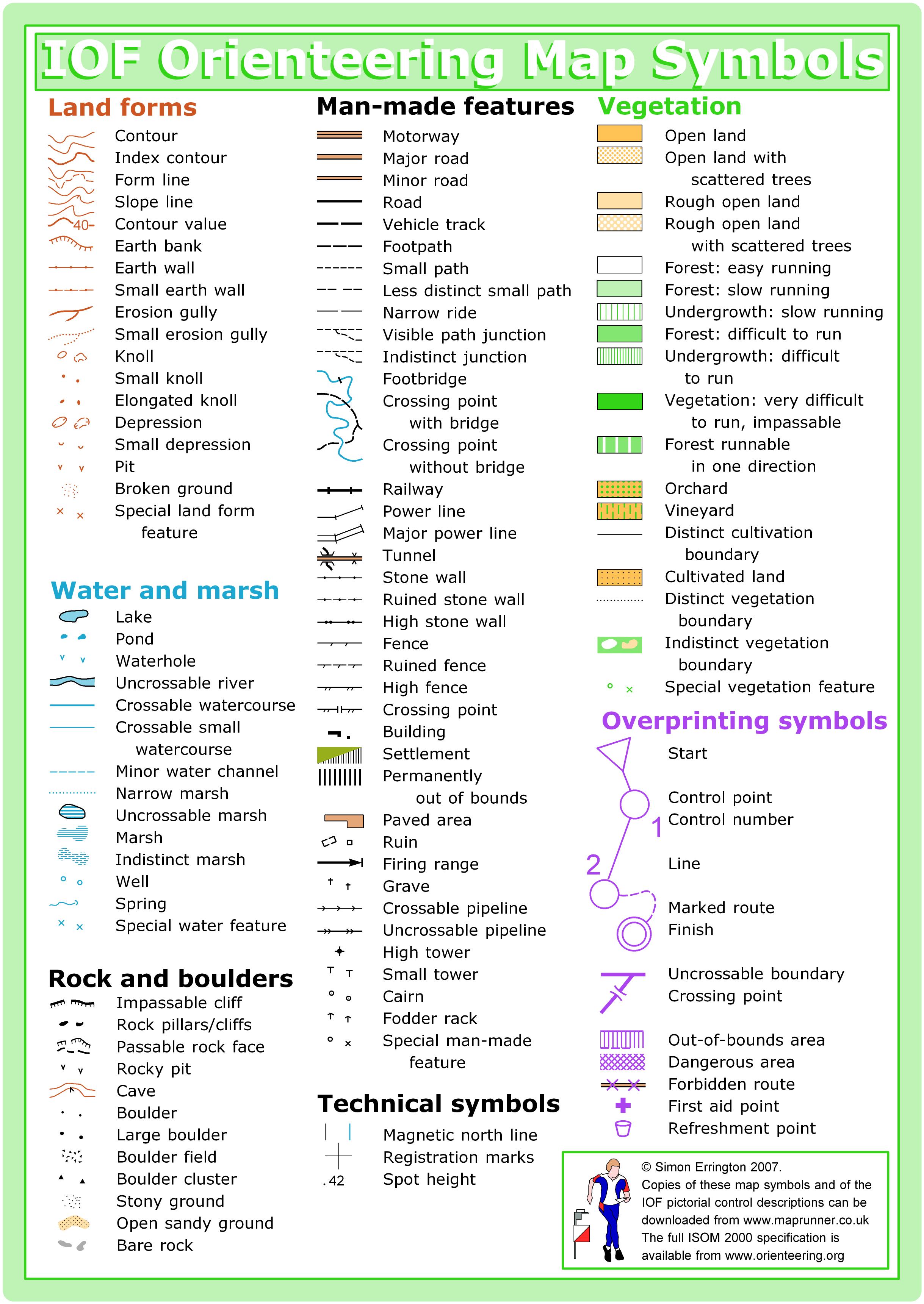
Special map features: black circles generally represent light poles and statues, the fodder rack symbol is used to designate bird houses on posts, the form lines generally include tick marks to indicate the low side, the ruined wall symbol is used to indicate lines of boulders setting off different areas of the park, and green x’s are used to indicate standing dead trees or large stumps.
SCHEDULE
9:30 am Team check-in opens
10:00 am Beginner instruction opens
10:30 am Team check-in closes
10:40 am Beginner instruction ends
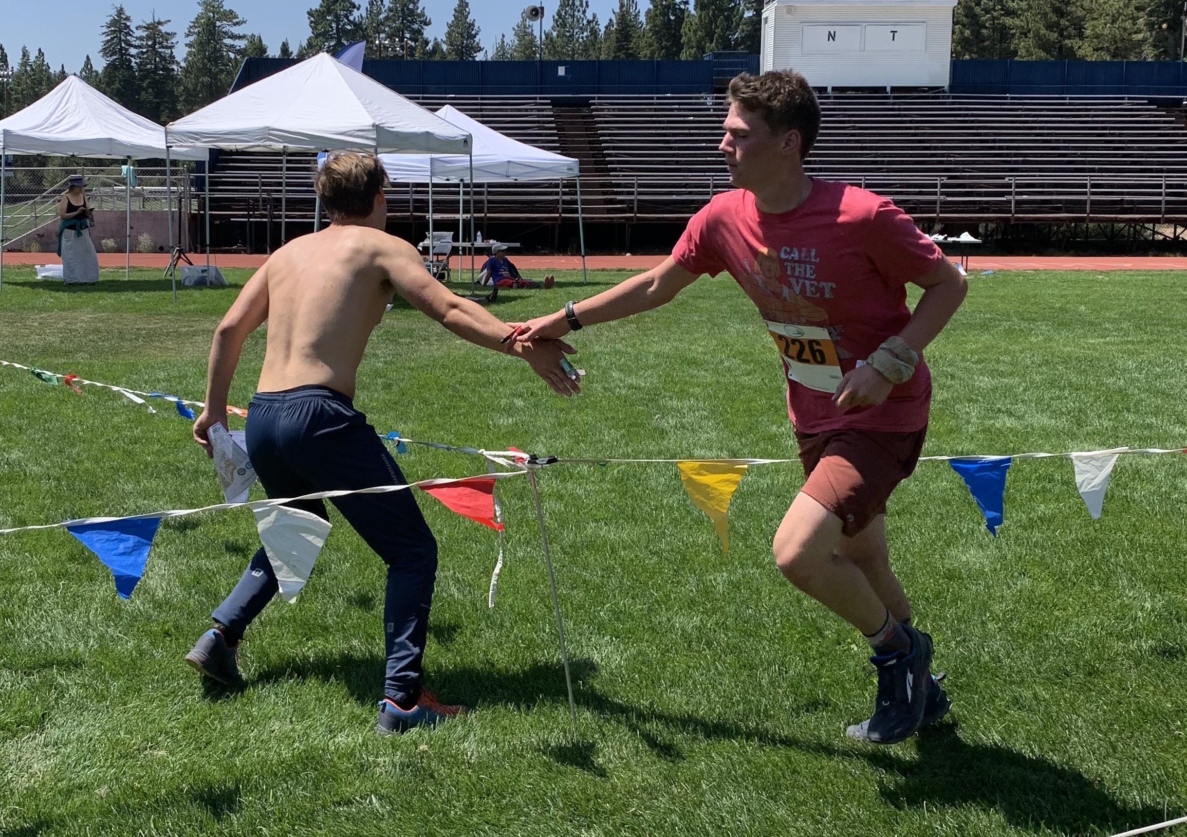
10:45 am Pre-start briefing; demonstration of exchange procedures
11:00 am Mass start
This event will be a mass start.
PRICES
PRE-REGISTRATION PRICES
$3 or 1.5 volunteer points = base price (Cascade OC members and non-members, with or without e-punch rental)
What’s an e-punch?
An e-punch records your race. At each control, you’ll dip the e-punch into an electronic box, which will beep and flash as confirmation. After you finish, you’ll download the e-punch at the download tent and get a receipt that show which controls you visited and how long you took between each; these are your “splits.”
Part of the fun of orienteering is comparing your splits with people who completed the same course, and discussing the routes you took!
SIGN UP
LOCATION
PARKING
Parking is at Lot I at Marymoor Park. Lot I is by the Velodrome. Marymoor charges $1 to park via machines in the parking lot that take cash or credit card. See site map here.
CARPOOL
Looking for a carpool? Join the Yahoo listserv and share your request to find a ride.
THE MAP
No map preview available
SAFETY & ETIQUETTE
Return to the Finish
All participants MUST return to the finish and download their e-punch or turn in their punch card.
Even if you have not finished your course, you must still return to the the finish and confirm with event staff that you have returned safely.
Out of Bounds
Some areas may be marked out of bounds. It is imperative to respect these boundaries to maintain our relationships with land managers. Participants MUST NOT go out of bounds. Any participant caught going out of bounds will be disqualified.
Course Closure
All participants MUST return to the finish by course closure time. If a participant does not return by course closure, event volunteers will begin coordinating a search party.
If you need a long time on the course, start as early in the start window as possible, wear a watch, and be prepared to cut your course short to make it back by the course closure time.
Whistle
All participants MUST carry a whistle on the course. Complimentary whistles are available at the start tent (please only take one).
If you are injured on the course and need assistance, blow three long blasts to call for help.
If you hear a call for help, abandon your course to find the person in distress.
Voices
Part of the fun and fairness of orienteering is navigating your own course, so please be polite when you find a checkpoint and don’t holler that you’ve found it.


