2023-24 Winter League #2 – North SeaTac Park
WINTER LEAGUE
Saturday, November 18 at North SeaTac Park in Seattle, WA
- Pre-registration is required for ALL Winter League Events. There is NO day-of-event registration.
- ALL runners will be called to enter the start procedure line 8 minutes prior to their assigned/picked start time. Please be race-ready when your name is called.
- 2023-24 Start Procedures are here.
- PUBLIC start time sign-ups are here, they are open from Nov. 4th at 3 p.m. to Nov. 15th at 11:59 p.m.
- Public Reg will close 11/15 at 11:59 pm for this meet.
- Read the 2023-24 WIOL Rules here and the 2023-24 Public Rules here.
- Site map is here.
- Start list is here.

Winter League is the Pacific Northwest’s premier competitive orienteering series for all ages.
- Elementary, Middle School, High School and College students compete under the banner of the Washington Interscholastic Orienteering League (WIOL).
- Winter League public courses offer a range of categories from a competitive long advanced category to non-competitive beginner-friendly categories at every event!
COURSES
Course designer(s): Kate Byers-Jensen & Rebecca Jensen
| Public Courses | Distance | Controls | Climb |
| Beginner | 1.1 km | 11 | 10 m |
| Adv. Beginner | 1.8 km | 11 | 20 m |
| Intermediate | 2.7 km | 15 | 50 m |
| Short Advanced | 4.0 km | 18 | 80 m |
| Long Advanced | 4.9 km | 22 | 80 m |
| WIOL Courses | Distance | Controls | Climb |
| Elementary | 1.1 km | 11 | 10 m |
| Middle School | 1.8 km | 11 | 20 m |
| JV Rookie Female | 2.1 km | 13 | 20 m |
| JV Rookie Male | 2.1 km | 12 | 20 m |
| JV Female | 2.7 km | 15 | 50 m |
| JV Male / College JV | 2.9 km | 15 | 50 m |
| High School Varsity | 3.7 km | 19 | 75 m |
| College Varsity | 4.9 km | 22 | 80 m |
How are courses measured?
Courses are measured as the crow flies, in a direct line from control to control. Unless you have wings, you will travel farther than this distance! Courses are measured in kilometers, so a good rule of thumb is to simply round up to miles to estimate how far you will go. So in a 5 kilometer race, you’ll likely travel up to 5 miles.
COURSE NOTES
START & PARKING
Welcome to North SeaTac Park, where the planes fly low and the disc golfers play. Parking and the Start/Finish are in DIFFERENT locations than usual, due to a recycling event happening in the main lot. Please park at the Boulevard Park Church on S 128th St, which is just north of the park. Walk west along 128th to the intersection with Des Moines Memorial Dr S, and take the crosswalk south into the northwest corner of the park. Here you’ll find both the Start and Finish. Restrooms are a short walk away along a paved path. See the site map here for more specific information about the parking and event layout.
ROAD CROSSING
North SeaTac Park is divided into two distinct halves, bisected by S 136th St where there is a mandatory ROAD CROSSING for Intermediate and Advanced courses. Anyone crossing the road outside of the mandatory crossing will be disqualified. The road crossing is indicated both on control descriptions and the map with a )( symbol. Magenta control lines will be going in and out of this )( bottleneck on the map, which can be tricky to read– so pay close attention that you’re headed to the right control after crossing the road. Particularly Short & Long Advanced, which have similar numbers going in and out of the mandatory crossing. Note – Elementary, Middle School, JV Rookie and Beginner courses do NOT cross the road.
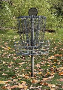
DISC GOLFERS
North SeaTac is a popular disc golf park and folks may be throwing discs while you’re on the course. The fairways start at paved rectangle “tee pads” and end at metal chain “baskets”. While no controls are placed directly on these features, some may be near them. Be aware of your surroundings and courteous to other park users. If you hear a shout, a good reflex is to cover your head. 🙂
OUT OF BOUNDS
All ball fields (baseball, soccer, rugby, etc) are out of bounds. Even if there is no one on the field, you may not cross. Anyone entering an out-of-bounds area will be disqualified.
THE MAP & ORIENTEERING TIPS
Contours are only 2.5m, not the usual 5m.
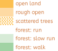
The NORTH and south sides of North SeaTac Park are distinctly different. The north is fairly flat and characterized by more open and runnable vegetation with small clusters of dense vegetation. In general, the clear areas of either “rough open land” (mapped tan) or “open forest” (mapped white) are reliably passable, and generally follow the corridors between tees and baskets. However, anything a shade of green may be either thicker or more passable than mapped.
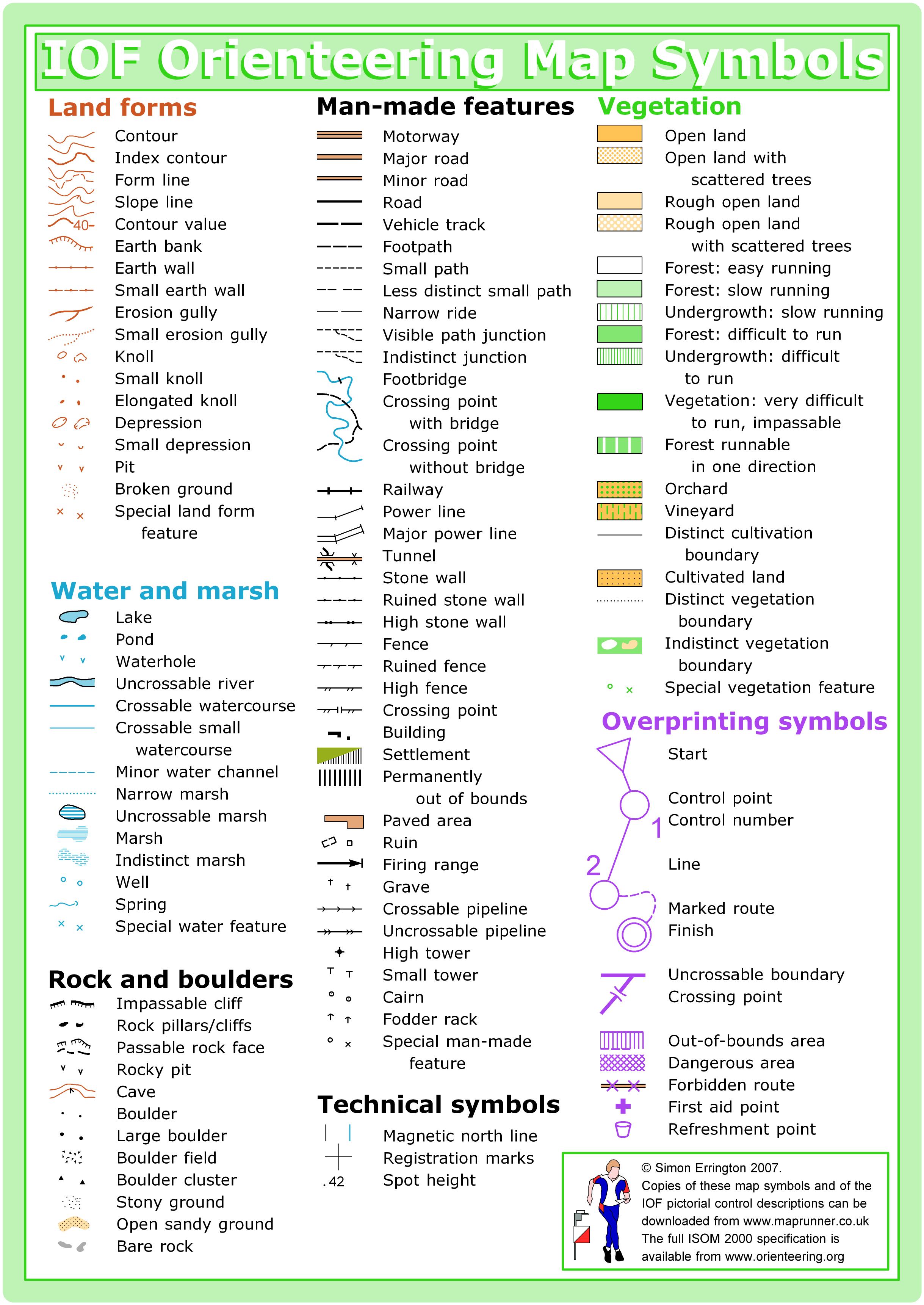
The north is also dotted with many disc golf baskets and tees. Baskets, which look like a bunch of chain hanging from a ring mounted on a pole, are marked on the map with a black empty triangle (solid black triangles are boulder clusters). These can be a handy orienteering feature, but be aware that you may encounter missing baskets or unmapped baskets, since they are occasionally moved! Where there is a missing basket you may still find a small stump of pole in the ground.
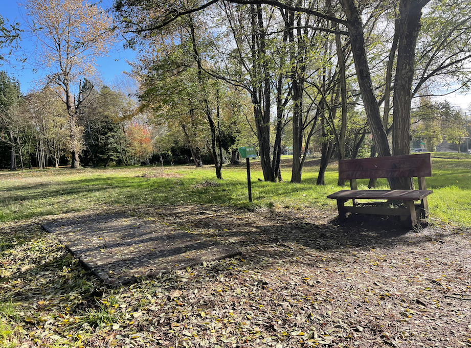
Tee pads, which are paved rectangles on the ground, are marked with a custom symbol, which is a rectangle with a black outline and “paved” pinkish-tan interior. It is a “custom symbol” because the size of the symbol greatly exaggerates the actual size of the paved pad, like other point feature symbols do. These are much more reliable for navigation than the baskets, as they do not move. 🙂 The flat pad can be hard to spot from far away, but they are typically accompanied by a small sign and a bench, which are easier to spot at a distance.
There are many dirt trails leading to various tees and baskets. Many of these trails peter off as you go away from the basket or tee, and some may be unmapped. There are also MANY leaves on the ground, which may obscure some of the minor trails, so you may need to look for other nearby features besides the trail itself to find it.
The SOUTH (south of the 136th St road crossing) has larger rolling hills and generally thicker vegetation. There is a grid of paved paths (former streets of a neighborhood!), and inside each rectangle a tight web of swirling trails motivated by mountain biking.
These webby trails (on the south side of the park) have been completely remapped! A huge thanks to Ethan O’Connor and his super-powered equipment, expertise, and enthusiasm, for working together with Rebecca Jensen to get this done.
Vegetation, however, has not been completely remapped. There areas where thick impassable growth has been cut down to open runnable woods, and conversely, cut-down areas have grown thicker and less passable.
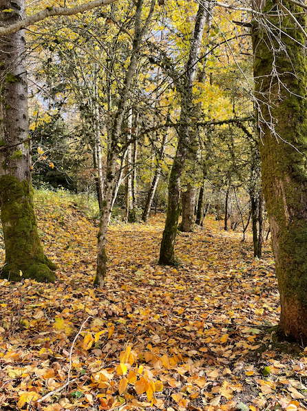
There’s been heavy leaf fall in the weeks leading up to the event, so some entry points to trails are quite hard to see, or may appear as open woods. Example of a hard-to-spot leaf-covered trail below, on the south side of the map. Photo taken on Sunday, November 12.
There are a LOT of controls, so be sure to check your control number! If you accidentally punch a control that’s not yours, that’s ok. As long as you punch all of your controls in the correct order, it doesn’t matter if you have some extra ones. 🙂
SCHEDULE
This event is Pre-Registration Only.
Schedule:
8:30 am – Training Begins
9 am – Info Tent and Newcomer Instruction Opens
9:36 am – Start process begins
9:44 am – First start
12:14 pm – Last Start
2:14 pm – Course Closure
Why is there a start window?
This event uses an interval start, meaning participants are started in waves instead of all at once. Winter League uses an expanded National Meet style start. You will be called to the first start tent 8 minutes prior to your assigned/picked start time. You will proceed through a series of start tents where you will verify your epunch and course, drop your coat, receive short essential course notes, get your control description sheets, clear and check, and receive your map. Please be race ready when your name is called.
PRICES
PRE-REGISTRATION PRICES
$22 base price
– subtract $5 for CascadeOC members
– subtract $5 for using your own e-punch
Participating as a group? Just $5 for each additional adult (16+) group
member, no cost for additional minors.
What’s an e-punch?
An e-punch records your race. At each control, you’ll dip the e-punch into an electronic box, which will beep and flash as confirmation. After you finish, you’ll download the e-punch at the download tent and get a receipt that show which controls you visited and how long you took between each; these are your “splits.”
Part of the fun of orienteering is comparing your splits with people who completed the same course, and discussing the routes you took!
SIGN UP
There is no Day-of-Event registration. Pre-registration will close Nov 15 at 11:59 pm.
Remember to also sign up for a start time for public runners here. Start time sign-ups for WL #2 will be open from Nov. 4th at 3 p.m. to Nov. 15th at 11:59 p.m.
LOCATION
PARKING
Please park at the Boulevard Park Church on S 128th St, which is just north of the park. Walk west along 128th to the intersection with Des Moines Memorial Dr S, and take the crosswalk south into the northwest corner of the park. Here you’ll find both the Start and Finish. Restrooms are a short walk away along a paved path. See the site map for more specific information about the parking and event layout.
CARPOOL
Looking for a carpool? Join the club email group and share your request to find a ride.
THE MAP
North SeaTac Park is a unique park–an answer to the question, “What would happen if all the people and their houses disappeared from a neighborhood?” There’s a mostly intact grid system of overgrown streets, trees and other vegetation that have grown back withe a vengeance, and open, grassy areas with intermittent vegetation clusters that are easy to navigate through if you don’t make a parallel feature error.
We typically start from the northeast area of the park, where there is ample parking and permanent restrooms. There is one busy street mid-course (on the longer courses), which usually has a crossing guard as a volunteer role.
Read more on the map pageFor info regarding training. preparation, and analysis for this event, click here🙂
![]()
SAFETY & ETIQUETTE
Return to the Finish
All participants MUST return to the finish and download their e-punch or turn in their punch card.
Even if you have not finished your course, you must still return to the the finish and confirm with event staff that you have returned safely.
Out of Bounds
Some areas may be marked out of bounds. It is imperative to respect these boundaries to maintain our relationships with land managers. Participants MUST NOT go out of bounds. Any participant caught going out of bounds will be disqualified.
Course Closure
All participants MUST return to the finish by course closure time. If a participant does not return by course closure, event volunteers will begin coordinating a search party.
If you need a long time on the course, start as early in the start window as possible, wear a watch, and be prepared to cut your course short to make it back by the course closure time.
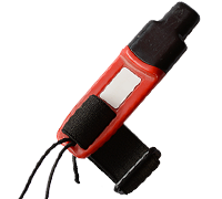
Whistle
All participants MUST carry a whistle on the course. Complimentary whistles are available at the start tent (please only take one).
If you are injured on the course and need assistance, blow three long blasts to call for help.
If you hear a call for help, abandon your course to find the person in distress.
Voices
Part of the fun and fairness of orienteering is navigating your own course, so please be polite when you find a checkpoint and don’t holler that you’ve found it.


