Ultimate Orienteer #2 – Long
Terrain update
Based on feedback from our vetters (Eric Bone was there 2/17 and Gabe Svobodny 2/19), we have shortened the courses for both days. Eric reported some snow on the ground, with drifts shin- to knee-deep, and a few spots near cliff bases thigh-deep. The warmer weather melted some of the snow by the time Gabe visited two days later. Even if more melts by this weekend, conditions could be mostly slow mud.
The traffic camera on I-90 at Exit 143 represents pretty closely the conditions at the event site.
Also, if you’re coming from Western Washington, please be sure to check conditions in the passes before heading over.
Desert Runs
We’re opening the 2017 Ultimate Orienteer Series with a collaboration between Forest Runs and Cascade for a 2-day event in eastern Washington. We’ll be using Forest Runs’ excellent map of Frenchman Coulee near Vantage, WA for Middle (Saturday) and Long (Sunday) events.
Weather
Temperatures are expected to be above freezing during the day and below freezing at night, with little to no snow. There’s a WSDOT traffic camera near Vantage that you can check for snow cover.
Other Things to Do
The map terrain and surrounding areas are unique and beautiful. Below are some other things to explore nearby.
- Wanapum Dam
- Crab Creek map area (25 miles south)
- Gingko Petrified Forest (interpretive center open by appointment only through March)
- Quincy Ancient Lakes – this area north of Frenchman Coulee has primitive camping areas and hiking with great views, as well as 2 orienteering maps
- Wineries – while there are several in the area, most are closed at this time of year; an exception is Cave B Winery and Resort
- The Gorge Amphitheatre (not much happening in February)
- Wild Horse Monument (a quick stop from eastbound I-90)
COURSES
Course designer(s): Peteris Ledins, Nikolay Nachev
There will be water at 2 locations.
Update 21 Feb; the courses have been shorted somewhat.
Beginner – 2.8 km, 50 meters climb, 10 controls
Intermediate – 5.4 km, 155 meters climb, 14 controls
Short Advanced – 8.1 km, 200 meters climb, 20 controls
Long Advanced – 11.0 km, 310 meters climb, 22 controls
How are courses measured?
Courses are measured as the crow flies, in a direct line from control to control. Unless you have wings, you will travel farther than this distance! Courses are measured in kilometers, so a good rule of thumb is to simply round up to miles to estimate how far you will go. So in a 5 kilometer race, you’ll likely travel up to 5 miles.
COURSE NOTES
Out of Bounds areas
Private property, areas of cultural significance, or dangerous slopes are marked on the map as out of bounds. There are no markings in the terrain, so please pay attention to where you are. One slope is marked on the map, as it might be tempting to cross it, but that would be both slippery and dangerous due to falling rocks.
Spectator location
After you’ve finished, if weather permits, the second-last control is a good place to view and cheer on your fellow competitors.
SCHEDULE
Registration: 9:00-11:15am
Starts: 9:30-11:30am
Course closure: 2:30pm (return to the finish by this time to avoid disqualification). Arrive early enough to complete your selected course by 2:30pm.
Newcomer instruction: 9:30-10:30am
Start/Finish
The start and finish are approximately 500m from registration/parking. Please allow time for this.
PRICES
PRE-REGISTRATION PRICES
$17 base price
– subtract $5 for CascadeOC members
– subtract $5 for using your own e-punch
DAY-OF-EVENT REGISTRATION
$20 base price
– subtract $5 for CascadeOC members
– subtract $5 for using your own e-punch
What’s an e-punch?
An e-punch records your race. At each control, you’ll dip the e-punch into an electronic box, which will beep and flash as confirmation. After you finish, you’ll download the e-punch at the download tent and get a receipt that show which controls you visited and how long you took between each; these are your “splits.”
Part of the fun of orienteering is comparing your splits with people who completed the same course, and discussing the routes you took!
SIGN UP
Online pre-registration closes: 9:00 pm, Thursday, February 23
Day-of-event registration is available by cash or check, made payable to Cascade Orienteering Club.
LOCATION
Directions
From the west
- From I-90 eastbound, take Exit 143 (East Silica Rd SW)
- Turn left on East Silica Rd SW and cross over I-90
- Turn left onto Vantage Rd
- Watch for orienteering signs to the parking area on the left
From the east
- From I-90 westbound, take Exit 143 (East Silica Rd SW)
- Turn right at the end of the ramp onto Vantage Rd
- Watch for orienteering signs to the parking area on the left
Parking
A Discover Pass is required. There is no on-site dispenser, so if you need a pass, purchase it in advance.
CARPOOL
Looking for a carpool? Join the Yahoo listserv and share your request to find a ride.
THE MAP
No map preview available
FRENCHMAN COULEE VENUE
Map
Scale: 1:10,000, 2.5m contour interval (printed at 1:15,000 for Long Advanced)
The first version of the Frenchman Coulee map was made in 2014 for a Homebrew Orienteering unofficial event. The courses and map from that event can be viewed here.
Since then, the map has been extended southwesterly (the “not really field-checked” note has been removed :)) and improved a lot.
Fieldwork is still in progress. Ott Toomet, Gabriel Svobodny, Don Atkinson, and Peteris Ledins have all done fieldwork for the latest version. Standard orienteering map symbols are used; there is no legend on the map but we have map symbol sheets available at registration. You can save time by familiarizing yourself with them in advance.
Special Use of Map Symbols
- Rocky ground – used for small rock or smaller cliff configurations without uniformity
- Knoll – used where the configuration is more uniform and hill-like, but there is no cliff face
- Rock – used when there seems to be a uniform piece of cliff that may be partly under the surface
The distinction between these rock and knoll symbols is interpreted by the mapper - Cliff – all four cliff face symbols are used
- Bare rock – used where the cliffs are runnable and uniform on top
Terrain
The terrain is open semi-desert with large coulee/rock/cliff features (lots of climbing activity near by). We expect 6 min/km for the fastest runners. What little vegetation there is is dominated by sage brush, but much of that is gone – a wildfire swept through a year or 2 ago. There are some larger trees that are now charred.
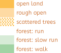
The most prevalent symbol on the map – rough open land. Land cover is very rugged – small stones, cliffs, big stones, boulders. Very tiring for the feet and knees.
Warnings
The footing is tricky, there are many high cliffs (the uncrossable cliff symbol is used for dangerous locations where you must not go).
Pits – in lower places which are a bit wetter throughout the year, but not enough to form a pond, meadows can be found. Some parts of the map have been used for livestock and people seem to have tried to get water in some organized shape. Several pits and rocky pits can be found there. Rocky pits can be fallen into. Please don’t do that.
Footing – cliffs with sand are slippery, stones roll, ankles too. Please be careful.
Rolling stones – if you knock loose a rock, shout loudly: “ROCK! ROCK!” But please don’t do that.
SAFETY & ETIQUETTE
Return to the Finish
All participants MUST return to the finish and download their e-punch or turn in their punch card.
Even if you have not finished your course, you must still return to the the finish and confirm with event staff that you have returned safely.
Out of Bounds
Some areas may be marked out of bounds. It is imperative to respect these boundaries to maintain our relationships with land managers. Participants MUST NOT go out of bounds. Any participant caught going out of bounds will be disqualified.
Course Closure
All participants MUST return to the finish by course closure time. If a participant does not return by course closure, event volunteers will begin coordinating a search party.
If you need a long time on the course, start as early in the start window as possible, wear a watch, and be prepared to cut your course short to make it back by the course closure time.
Whistle
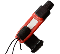
All participants MUST carry a whistle on the course. Complimentary whistles are available at the start tent (please only take one).
If you are injured on the course and need assistance, blow three long blasts to call for help.
If you hear a call for help, abandon your course to find the person in distress.
Voices
Part of the fun and fairness of orienteering is navigating your own course, so please be polite when you find a checkpoint and don’t holler that you’ve found it.


