Winter League #4 – Bridle Trails State Park
WINTER LEAGUE
Saturday, December 21 at Bridle Trails State Park in Kirkland, WA
Meet Director: Jud Kelley
-
This is another TRAILS ONLY event. Please navigate on your own and stay on trails.
-
Bridle Trails is a park shared with horses and their riders, and the rules of the park state : Runners have the responsibility to make their presence known to equestrians and to stand by the side of the trail until horses pass.
-
If you are trying to pass a horse and rider from behind, please announce your presence and ask if it is alright to pass. Wait for the rider to answer and pass with as much clearance as possible.
-
A Discover Pass is required to park at this venue.
-
Please see site map for parking, registration, etc
-
DO NOT park on NE 60th and walk through the park to the registration area – you will be DQ’d from competition for the day!
What is Winter League?
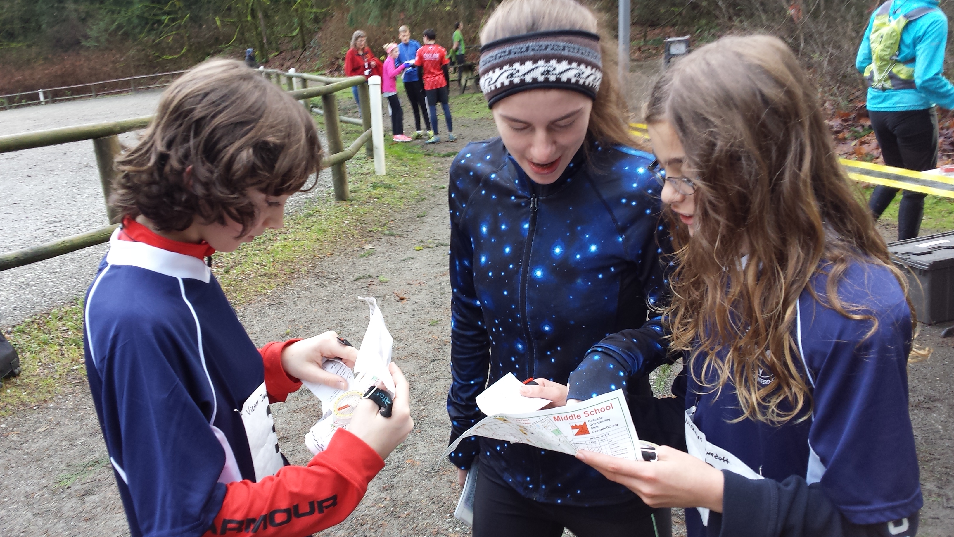
Winter League is the Pacific Northwest’s premier competitive orienteering series for all ages. Elementary, Middle School, and High School students compete under the banner of the Washington Interscholastic Orienteering League (WIOL). Cascade Orienteering Club also offers a competitive league for college students and adults, as well as non-competitive beginner-friendly categories at every event!
COURSES
Course designer(s): Dave Dummeyer and Serge Smirnov
|
Course |
Controls |
Length |
Climb |
| Elementary/Beginner | 8 | 1.3 km | 30 m |
| Middle School | 7 | 2.3 km | 40 m |
| JV Rookie/Advanced Beginner | 7 | 2.2 km | 40 m |
| JV Girls/Intermediate | 8 | 3.2 km | 45 m |
| JV Boys | 9 | 3.0 km | 60 m |
| Varsity | 10 | 4.4 km | 70 m |
| Short Advanced | 10 | 4.2 km | 70 m |
| Long Advanced | 12 | 6.2 km | 100 m |
How are courses measured?
Courses are measured as the crow flies, in a direct line from control to control. Unless you have wings, you will travel farther than this distance! Courses are measured in kilometers, so a good rule of thumb is to simply round up to miles to estimate how far you will go. So in a 5 kilometer race, you’ll likely travel up to 5 miles.
COURSE NOTES
-
This is a trails only venue
-
Please yield to equestrians per park rules
- Expect remnants of horse droppings on trails
- Beginner/Elementary, Middle School, and Intermediate/JV Girls stay entirely west of the powerline
- Please only use trails that are marked on your map and which are obvious in the terrain! (Yes, even the indistinct trails are generally easy to find and follow.)
- Bridle trails is quite flat outside of the climb just east of the start/finish area, and running on trails means you can move quickly across this 1:10k map. Advanced orienteers will read ahead to know which direction to turn before reaching a junction and plan optimal routes through the maze of possible trails.
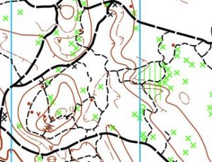
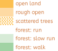
- Overall the map is good, and though forest vegetation can be inconsistent (and is generally all thicker than the white shown on most of the map), it shouldn’t affect trails-only navigation. A few special notes:
- This map uses a green O for a stump, and the control description sheets will use an “O” symbol for these to differentiate from a rootstock (which uses the normal brown x on the map and circle with x on control descriptions.)
- There are also two sizes of black X on the map. The larger black X are large signboards with a roof, while the smaller black x are either posts for trail marking or smaller interpretive signage.
- Settlement out of bounds areas are marked with grey lines rather than olive green fill. You may use mapped trails and roads to pass through these areas, though most courses shouldn’t need to go outside of the park.
SCHEDULE
9:30 am – Registration opens
9:30 am – Newcomer instruction available
10:00 am – Start opens
11:45pm – Registration closes
Noon – Newcomer instruction ends
Noon – Start closes
2:30 pm – Course closes
**PLEASE NOTE COURSE CLOSURE IS NOW 2:30 PM FOR ALL WINTER LEAGUE MEETS**
Why is there a start window?
This event uses an interval start, which means that participants are started in waves instead of all at once. When you arrive at the start tent, find the chute for your course and follow the start volunteer’s instructions.
PRICES
PRE-REGISTRATION PRICES
$17 base price
– subtract $5 for CascadeOC members
– subtract $5 for using your own e-punch
DAY-OF-EVENT REGISTRATION
$20 base price
– subtract $5 for CascadeOC members
– subtract $5 for using your own e-punch
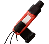
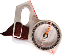
What’s an e-punch?
An e-punch records your race. At each control, you’ll dip the e-punch into an electronic box, which will beep and flash as confirmation. After you finish, you’ll download the e-punch at the download tent and get a receipt that show which controls you visited and how long you took between each; these are your “splits.”
Part of the fun of orienteering is comparing your splits with people who completed the same course, and discussing the routes you took!
SIGN UP
Online pre-registration closes:
Day-of-event registration is available by cash or check, made payable to Cascade Orienteering Club
LOCATION
PARKING
-
Parking is available at the park, please see site map. We expect parking to be tight so please car pool and follow the parking staff directions.
-
A Discover Pass is required.
-
Limited overflow parking is available at Lake East Christian Church, 5241 – 116th Ave NE.
CARPOOL
Looking for a carpool? Join the Yahoo listserv and share your request to find a ride.
THE MAP
Bridle trails is an on-trail-only venue, with chest-deep salal on both sides and rumors of some old wells and pits in the underbrush. But it makes up for this navigational limitation by having an intricate network of trails that make it a perfect place to practice a range of skills:
- Feature recognition (What is the shape of this trail?)
- Compass use (Which way does this trail go?)
- Pace counting (Should I be expecting an intersection soon?)
- Contours (Is this trail supposed to be going down or up?)
Navigationally, this is a 1:10,000 map of three levels of trail network and a wide power line strip through the center. It is bounded on the outer edge by a series of perimeter trails that border roads, with a center of activity on the west side.
NOTE: Bridle Trails is a horse-focused park. If a horse is on course and need to approach, slow down and make your presence known verbally to keep the horse from spooking. The animals may be bigger than you, but you’re a lot scarier than they are!
Read more on the map pageSAFETY & ETIQUETTE
Return to the Finish
All participants MUST return to the finish and download their e-punch or turn in their punch card.
Even if you have not finished your course, you must still return to the the finish and confirm with event staff that you have returned safely.
Out of Bounds
Some areas may be marked out of bounds. It is imperative to respect these boundaries to maintain our relationships with land managers. Participants MUST NOT go out of bounds. Any participant caught going out of bounds will be disqualified.
Course Closure
All participants MUST return to the finish by course closure time. If a participant does not return by course closure, event volunteers will begin coordinating a search party.
If you need a long time on the course, start as early in the start window as possible, wear a watch, and be prepared to cut your course short to make it back by the course closure time.
Whistle
All participants MUST carry a whistle on the course. Complimentary whistles are available at the start tent (please only take one).
If you are injured on the course and need assistance, blow three long blasts to call for help.
If you hear a call for help, abandon your course to find the person in distress.
Voices
Part of the fun and fairness of orienteering is navigating your own course, so please be polite when you find a checkpoint and don’t holler that you’ve found it.


